Big Data

What are big data?

“Big data” are also data, but involve far larger amounts of data than can usually be handled on a desktop computer or in a traditional database. Big data are not only huge in volume, but they grow exponentially with time. Big data are so large and complex that none of the traditional data-management tools are able to store them or process them efficiently. If you have an amount of data that you can process on your computer or the database on your usual server without it crashing, “big data” are likely not what you are working with.

How does big data work?

The field of big data has evolved as technology’s ability to constantly capture information has skyrocketed. Big data are usually captured without being entered into a database by a human being, in real time: in other words, big data are “passively” captured by digital devices.

The internet provides infinite opportunities to gather information, ranging from so-called meta-information or metadata (geographic location, IP address, time, etc.) to more detailed information about users’ behaviors. This is often from online social media or credit card-purchasing behavior. Cookies are one of the principal ways that web browsers gather information about users: they are essentially tiny pieces of data stored on a web browser, or little bits of memory about something you did on a website. (For more on cookies, visit this resource).

Data sets can also be assembled from the Internet of Things, which involves sensors tied to other devices and networks. For example, censor-equipped streetlights might collect traffic information that can then be analyzed to optimize traffic flow. The collection of data through sensors is a common element of smart city infrastructure.

Healthcare workers in Indonesia. The use of big data can improve health systems and inform public health policies. Photo credit: courtesy of USAID EMAS.

Big data can also be medical or scientific data, such as DNA information or data related to disease outbreaks. This can be useful to humanitarian and development organizations. For example, during the Ebola outbreak in West Africa between 2014 and 2016, UNICEF combined data from a number of sources, including population estimates, information on air travel, estimates of regional mobility from mobile phone records and tagged social media locations, temperature data, and case data from WHO reports to better understand the disease and predict future outbreaks.

Big data are created and used by a variety of actors. In data-driven societies, most actors (private sector, governments, and other organizations) are encouraged to collect and analyze data to notice patterns and trends, measure success or failure, optimize their processes for efficiency, etc. Not all actors will create datasets themselves, often they will collect publicly available data or even purchase data from specialized companies. For instance, in the advertising industry, Data Brokers specialize in collecting and processing information about internet users, which they then sell to advertisers. Other actors will create their own datasets, like energy providers, railway companies, ride-sharing companies, and governments. Data are everywhere, and the actors capable of collecting them intelligently and analyzing them are numerous.

Back to top

How is big data relevant in civic space and for democracy?

In Tanzania, an open-source platform allows government and financial institutions to record all land transactions to create a comprehensive dataset. Photo credit: Riaz Jahanpour for USAID / Digital Development Communications.

From forecasting presidential elections to helping small-scale farmers deal with changing climate to predicting disease outbreaks, analysts are finding ways to turn Big Data into an invaluable resource for planning and decision-making. Big data are capable of providing civil society with powerful insights and the ability to share vital information. Big data tools have been deployed recently in civic space in a number of interesting ways, for example, to:

  • monitor elections and support open government (starting in Kenya with Ushahidi in 2008)
  • track epidemics like Ebola in Sierra Leone and other West African nations
  • track conflict-related deaths worldwide
  • understand the impact of ID systems on refugees in Italy
  • measure and predict agricultural success and distribution in Latin America
  • press forward with new discoveries in genetics and cancer treatment
  • make use of geographic information systems (GIS mapping applications) in a range of contexts, including planning urban growth and traffic flow sustainably, as has been done by the World Bank in various countries in South Asia, East Asia, Africa, and the Caribbean

The use of big data that are collected, processed, and analyzed to improve health systems or environmental sustainability, for example, can ultimately greatly benefit individuals and society. However, a number of concerns and cautions have been raised about the use of big datasets. Privacy and security concerns are foremost, as big data are often captured without our awareness and used in ways to which we may not have consented, sometimes sold many times through a chain of different companies we never interacted with, exposing data to security risks such as data breaches. It is crucial to consider that anonymous data can still be used to “re-identify” people represented in the dataset – achieving 85% accuracy using as little as postal code, gender, and date of birth – conceivably putting them at risk (see discussion of “re-identification” below).

There are also power imbalances (divides) in who is represented in the data as opposed to who has the power to use them. Those who are able to extract value from big data are often large companies or other actors with the financial means and capacity to collect (sometimes purchase), analyze, and understand the data.

This means the individuals and groups whose information is put into datasets (shoppers whose credit card data is processed, internet users whose clicks are registered on a website) do not generally benefit from the data they have given. For example, data about what items shoppers buy in a store is more likely used to maximize profits than to help customers with their buying decisions. The extractive way that data are taken from individuals’ behaviors and used for profit has been called “surveillance capitalism“, which some believe is undermining personal autonomy and eroding democracy.

The quality of datasets must also be taken into consideration, as those using the data may not know how or where they were gathered, processed, or integrated with other data. And when storing and transmitting big data, security concerns are multiplied by the increased numbers of machines, services, and partners involved. It is also important to keep in mind that big datasets themselves are not inherently useful, but they become useful along with the ability to analyze them and draw insights from them, using advanced algorithms, statistical models, etc.

Last but not least, there are important considerations related to protecting the fundamental rights of those whose information appears in datasets. Sensitive, personally identifiable, or potentially personally identifiable information can be used by other parties or for other purposes than those intended, to the detriment of the individuals involved. This is explored below and in the Risks section, as well as in other primers.

Protecting anonymity of those in the dataset

Anyone who has done research in the social or medical sciences should be familiar with the idea that when collecting data on human subjects, it is important to protect their identities so that they do not face negative consequences from being involved in research, such as being known to have a particular disease, voted in a particular way, engaged in stigmatized behavior, etc. (See the Data Protection resource). The traditional ways of protecting identities – removing certain identifying information, or only reporting statistics in aggregate – can and should also be used when handling big datasets to help protect those in the dataset. Data can also be hidden in multiple ways to protect privacy: methods include encryption (encoding), tokenization, and data masking. Talend identifies the strengths and weaknesses of the primary strategies for hiding data using these methods.

One of the biggest dangers involved in using big datasets is the possibility of re-identification: figuring out the real identities of individuals in the dataset, even if their personal information has been hidden or removed. To give a sense of how easy it could be to identify individuals in a large dataset, one study found that using only three fields of information—postal code, gender, and date of birth—it was possible to identify 87% of Americans individually, and then connect their identities to publicly-available databases containing hospital records. With more data points, researchers have demonstrated a near-perfect ability to identify individuals in a dataset: four random pieces of data credit card records could achieve 90% identifiability, and researchers were able to re-identify individuals with 99.98% accuracy using 15 data points.

Ten simple rules for responsible big data research, quoted from a paper of the same name by Zook, Barocas, Boyd, Crawford, Keller, Gangadharan, et al, 2017

  1. Acknowledge that data are people and that data can do harm. Most data represent or affect people. Simply starting with the assumption that all data are people until proven otherwise places the difficulty of disassociating data from specific individuals front and center.
  2. Recognize that privacy is more than a binary value. Privacy may be more or less important to individuals as they move through different contexts and situations. Looking at someone’s data in bulk may have different implications for their privacy than looking at one record. Privacy may be important to groups of people (say, by demographic) as well as to individuals.
  3. Guard against the reidentification of your data. Be aware that apparently harmless, unexpected data, like phone battery usage, could be used to re-identify data. Plan to ensure your data sharing and reporting lowers the risk that individuals could be identified.
  4. Practice ethical data sharing. There may be times when participants in your dataset expect you to share (such as with other medical researchers working on a cure), and others where they trust you not to share their data. Be aware that other identifying data about your participants may be gathered, sold, or shared about them elsewhere, and that combining that data with yours could identify participants individually. Be clear about how and when you will share data and stay responsible for protecting the privacy of the people whose data you collect.
  5. Consider the strengths and limitations of your data; big does not automatically mean better. Understand where your large dataset comes from, and how that may evolve over time. Don’t overstate your findings and acknowledge when they may be messy or have multiple meanings.
  6. Debate the tough, ethical choices. Talk with your colleagues about these ethical concerns. Follow the work of professional organizations to stay current with concerns.
  7. Develop a code of conduct for your organization, research community, or industry and engage your peers in creating it to ensure unexpected or under-represented perspectives are included.
  8. Design your data and systems for auditability. This both strengthens the quality of your research and services and can give early warnings about problematic uses of the data.
  9. Engage with the broader consequences of data and analysis practices. Keep social equality, the environmental impact of big data processing, and other society-wide impacts in view as you plan big data collection.
  10. Know when to break these rules. With debate, code of conduct, and auditability as your guide, consider that in a public health emergency or other disaster, you may find there are reasons to put the other rules aside.

Gaining informed consent

Those providing their data may not be aware at the time that their data may be sold later to data brokers who may then re-sell them.

Unfortunately, data privacy consent forms are generally hard for the average person to read, even in the wake of General Data Protection Regulation (GDPR ) expansion of privacy protections. Terms of Service (ToS documents) are so notoriously difficult to read that one filmmaker even made a documentary on the subject. Researchers who have studied terms of service and privacy policies have found that users generally accept them without reading them because they are too long and complex. Otherwise, users that need to access a platform or service for personal reasons (for example to get in contact with a relative) or for their livelihood (to deliver their products to customers) may not be able to simply reject the ToS when they have no viable or immediate alternative.

Important work is being done to try to protect users of platforms and services from these kinds of abusive data-sharing situations. For example, Carnegie Mellon’s Usable Privacy and Security laboratory (CUPS) has developed best practices to inform users about how their data may be used. These take the shape of data privacy “nutrition labels” that are similar to FDA-specified food nutrition labels and are evidence-based.

In Chipata, Zambia, a resident draws water from a well. Big data offer invaluable insights for the design of climate change solutions. Photo credit: Sandra Coburn.

Back to top

Opportunities

Big data can have positive impacts when used to further democracy, human rights, and governance issues. Read below to learn how to more effectively and safely think about big data in your work.

Greater insight

Big datasets can present some of the richest, most comprehensive information that has ever been available in human history. Researchers using big datasets have access to information from a massive population. These insights can be much more useful and convenient than self-reported data or data gathered from logistically tricky observational studies. One major trade-off is between the richness of the insights gained through self-reported or very carefully collected data, versus the ability to generalize the insights from big data. Big data gathered from social-media activity or sensors also can allow for the real-time measurements of activity at a large scale. Big data insights are very important in the field of logistics. For example, the United States Postal Service collects data from across its package deliveries using GPS and vast networks of sensors and other tracking methods, and they then process these data with specialized algorithms. These insights allow them to optimize their deliveries for environmental sustainability.

Increased access to data

Making big datasets publicly available can begin to take steps toward closing divides in access to data. Apart from some public datasets, big data often ends up as the property of corporations, universities, and other large organizations. Even though the data produced are about individual people and their communities, those individuals and communities may not have the money or technical skills needed to access those data and make productive use of them. This creates the risk of worsening existing digital divides.

Publicly available data have helped communities understand and act on government corruption, municipal issues, human-rights abuses, and health crises, among other things. Though again, when data are made public, they are of particular importance to ensure strong privacy for those whose data is in the dataset. The work of the Our Data Bodies project provides additional guidance for how to engage with communities whose data is in the datasets. Their workshop materials can support community understanding and engagement in making ethical decisions around data collection and processing, and about how to monitor and audit data practices.

Back to top

Risks

The use of emerging technologies to collect data can also create risks in civil society programming. Read below on how to discern the possible dangers associated with big data collection and use in DRG work, as well as how to mitigate for unintended – and intended – consequences.

Surveillance

With the potential for re-identification as well as the nature and aims of some uses of big data, there is a risk that individuals included in a dataset will be subjected to surveillance by governments, law enforcement, or corporations. This may put the fundamental rights and safety of those in the dataset at risk.

The Chinese government is routinely criticized for the invasive surveillance of Chinese citizens through gathering and processing big data. More specifically, the Chinese government has been criticized for their system of social ranking of citizens based on their social media, purchasing, and education data, as well as the gathering of DNA of members of the Uighur minority (with the assistance of a US company, it should be noted). China is certainly not the only government to abuse citizen data in this way. Edward Snowden’s revelations about the US National Security Agency’s gathering and use of social media and other data were among the first public warnings about the surveillance potential of big data. Concerns have also been raised about partnerships involved in the development of India’s Aadhar biometric ID system, a technology whose producers are eager to sell it to other countries. In the United States, privacy advocates have raised concerns about companies and governments gathering data at scale about students by using their school-provided devices, a concern that should also be raised in any international context when laptops or mobiles are provided for students.

It must be emphasized that surveillance concerns are not limited to the institutions originally gathering the data, whether governments or corporations. When data are sold or combined with other datasets, it is possible that other actors, from email scammers to abusive domestic partners, could access the data and track, exploit, or otherwise harm people appearing in the dataset.

Data security concerns

Because big data are collected, cleaned, and combined through long, complex pipelines of software and storage, it presents significant challenges for security. These challenges are multiplied whenever the data are shared between many organizations. Any stream of data arriving in real time (for example, information about people checking into a hospital) will need to be specifically protected from tampering, disruption, or surveillance. Given that data may present significant risks to the privacy and safety of those included in the datasets and may be very valuable to criminals, it is important to ensure sufficient resources are provided for security.

Existing security tools for websites are not enough to cover the entire big data pipeline. Major investments in staff and infrastructure are needed to provide proper security coverage and respond to data breaches. And unfortunately, within the industry, there are known shortages of big data specialists, particularly security personnel familiar with the unique challenges big data presents. Internet of Things sensors present a particular risk if they are part of the data-gathering pipeline; these devices are notorious for having poor security. For example, a malicious actor could easily introduce fake sensors into the network or fill the collection pipeline with garbage data in order to render your data collection useless.

Exaggerated expectations of accuracy and objectivity

Big data companies and their promoters often make claims that big data can be more objective or accurate than traditionally-gathered data, supposedly because human judgment does not come into play and because the scale at which it is gathered is richer. This picture downplays the fact that algorithms and computer code also bring human judgment to bear on data, including biases and data that may be accidentally excluded. Human interpretation is also always necessary to make sense of patterns in big data; so again, claims of objectivity should be taken with healthy skepticism.

It is important to ask questions about data-gathering methods, algorithms involved in processing, and the assumptions or inferences made by the data gatherers/programmers and their analyses to avoid falling into the trap of assuming big data are “better.” For example, while data about the proximity of two cell phones tells you the fact that two people were near each other, only human interpretation can tell you why those two people were near each other. How an analyst interprets that closeness may differ from what the people carrying the cell phones might tell you. For example, this is a major challenge in using phones for “contact tracing” in epidemiology. During the COVID-19 health crisis, many countries raced to build contact tracing cellphone apps. The precise purposes and functioning of these apps varies widely (as has their effectiveness) but it is worth noting that major tech companies have preferred to refer to these apps as “exposure-risk notification” apps rather than contact tracing: this is because the apps can only tell you if you have been in proximity with someone with the coronavirus, not whether or not you have contacted the virus.

Misinterpretation

As with all data, there are pitfalls when it comes to interpreting and drawing conclusions. Because big data is often captured and analyzed in real-time, it may be particularly weak in providing historical context for the current patterns it is highlighting. Anyone analyzing big data should also consider what its source or sources were, whether the data was combined with other datasets, and how it was cleaned. Cleaning refers to the process of correcting or removing inaccurate or extraneous data. This is particularly important with social-media data, which can have lots of “noise” (extra information) and are therefore almost always cleaned.

Back to top

Questions

If you are trying to understand the implications of big data in your work environment, or are considering using aspects of big data as part of your DRG programming, ask yourself these questions:

  1. Is gathering big data the right approach for the question you’re trying to answer? How would your question be answered differently using interviews, historical research, or a focus on statistical significance?
  2. Do you already have these data, or are they publicly available? Is it really necessary to acquire these data yourself?
  3. What is your plan to make it impossible to identify individuals through their data in your dataset? If the data come from someone else, what kind of de-anonymization have they already performed?
  4. How could individuals be made more identifiable by someone else when you publish your data and findings? What steps can you take to lower the risk they will be identified?
  5. What is your plan for getting consent from those whose data you are collecting? How will you make sure your consent document is easy for them to understand?
  6. If your data come from another organization, how did they seek consent? Did that consent include consent for other organizations to use the data?
  7. If you are getting data from another organization, what is the original source of these data? Who collected them, and what were they trying to accomplish?
  8. What do you know about the quality of these data? Is someone inspecting them for errors, and if so, how? Did the collection tools fail at any point, or do you suspect that there might be some inaccuracies or mistakes?
  9. Have these data been integrated with other datasets? If data were used to fill in gaps, how was that accomplished?
  10. What is the end-to-end security plan for the data you are capturing or using? Are there third parties involved whose security propositions you need to understand?

Back to top

Case Studies

Village resident in Tanzania. Big data analytics can pinpoint strategies that work for small-scale farmers. Photo credit: Riaz Jahanpour for USAID / Digital Development Communications.
Big Data for climate-smart agriculture

Big Data for climate-smart agriculture

“Scientists at the International Center for Tropical Agriculture (CIAT) have applied Big Data tools to pinpoint strategies that work for small-scale farmers in a changing climate…. Researchers have applied Big Data analytics to agricultural and weather records in Colombia, revealing how climate variation impacts rice yields. These analyses identify the most productive rice varieties and planting times for specific sites and seasonal forecasts. The recommendations could potentially boost yields by 1 to 3 tons per hectare. The tools work wherever data is available, and are now being scaled out through Colombia, Argentina, Nicaragua, Peru and Uruguay.”

School Issued Devices and Student Privacy

School-Issued Devices and Student Privacy, particularly the Best Practices for Ed Tech Companies section.

“Students are using technology in the classroom at an unprecedented rate…. Student laptops and educational services are often available for a steeply reduced price and are sometimes even free. However, they come with real costs and unresolved ethical questions. Throughout EFF’s investigation over the past two years, [they] have found that educational technology services often collect far more information on kids than is necessary and store this information indefinitely. This privacy-implicating information goes beyond personally identifying information (PII) like name and date of birth, and can include browsing history, search terms, location data, contact lists, and behavioral information…All of this often happens without the awareness or consent of students and their families.”

Big Data and Thriving Cities: Innovations in Analytics to Build Sustainable, Resilient, Equitable and Livable Urban Spaces.

Big Data and Thriving Cities: Innovations in Analytics to Build Sustainable, Resilient, Equitable and Livable Urban Spaces.

This paper includes case studies of big data used to track changes in urbanization, traffic congestion, and crime in cities. “[I]nnovative applications of geospatial and sensing technologies and the penetration of mobile phone technology are providing unprecedented data collection. This data can be analyzed for many purposes, including tracking population and mobility, private sector investment, and transparency in federal and local government.”

Battling Ebola in Sierra Leone: Data Sharing to Improve Crisis Response.

Battling Ebola in Sierra Leone: Data Sharing to Improve Crisis Response.

“Data and information have important roles to play in the battle not just against Ebola, but more generally against a variety of natural and man-made crises. However, in order to maximize that potential, it is essential to foster the supply side of open data initiatives – i.e., to ensure the availability of sufficient, high-quality information. This can be especially challenging when there is no clear policy backing to push actors into compliance and to set clear standards for data quality and format. Particularly during a crisis, the early stages of open data efforts can be chaotic, and at times redundant. Improving coordination between multiple actors working toward similar ends – though difficult during a time of crisis – could help reduce redundancy and lead to efforts that are greater than the sum of their parts.”

Tracking Conflict-Related Deaths: A Preliminary Overview of Monitoring Systems.

Tracking Conflict-Related Deaths: A Preliminary Overview of Monitoring Systems.

“In the framework of the United Nations 2030 Agenda for Sustainable Development, states have pledged to track the number of people who are killed in armed conflict and to disaggregate the data by sex, age, and cause—as per Sustainable Development Goal (SDG) Indicator 16. However, there is no international consensus on definitions, methods, or standards to be used in generating the data. Moreover, monitoring systems run by international organizations and civil society differ in terms of their thematic coverage, geographical focus, and level of disaggregation.”

Balancing data utility and confidentiality in the US census.

Balancing data utility and confidentiality in the US census.

Describes how the Census is using differential privacy to protect the data of respondents. “As the Census Bureau prepares to enumerate the population of the United States in 2020, the bureau’s leadership has announced that they will make significant changes to the statistical tables the bureau intends to publish. Because of advances in computer science and the widespread availability of commercial data, the techniques that the bureau has historically used to protect the confidentiality of individual data points can no longer withstand new approaches for reconstructing and reidentifying confidential data. … [R]esearch at the Census Bureau has shown that it is now possible to reconstruct information about and reidentify a sizeable number of people from publicly available statistical tables. The old data privacy protections simply don’t work anymore. As such, Census Bureau leadership has accepted that they cannot continue with their current approach and wait until 2030 to make changes; they have decided to invest in a new approach to guaranteeing privacy that will significantly transform how the Census Bureau produces statistics.”

Back to top

References

Find below the works cited in this resource.

Additional Resources

Back to top

Categories

Satellite Systems

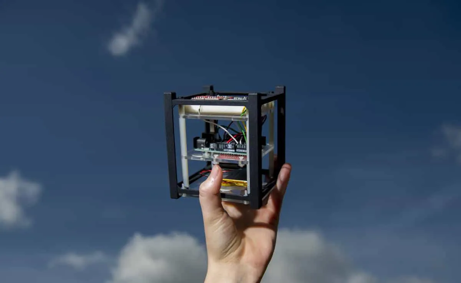
Irvine03 CubeSat Source: https://ipsf.net/news/nasa-selects-irvine03-cubesat-for-launch-mission/

What is a satellite?

A satellite is an object that orbits a planet or star; it can be a natural body like the Moon orbiting Earth, or an artificial object deployed by humans for diverse functions, including communication, Earth observation, navigation, and scientific exploration.

While Earth has one natural satellite, the Moon, several thousand artificial satellites trace orbits around the Earth. These human-made satellites range from 10 centimeter cubes weighing about a kilogram, called SmallSats, to the International Space Station. Each carries instruments to perform specific tasks like connecting distant points through telecommunications links and observing Earth’s surface.

NASA & STS-132 Crew: Flyaround view of the International Space Station Source: https://images.nasa.gov/details-s132e012208

How do satellites work?

Satellites use specialized instruments to perform applications such as communication, Earth observation, navigation, and scientific research, collecting and transmitting relevant data back to ground stations, while being remotely managed and controlled.

At the most basic level, satellite systems have three component segments: the space segment, the terrestrial segment, and the data link between the two. In satellite systems that are comprised of multiple space objects, there is also often a data link between the satellites. Since satellites in Earth’s orbit can be several thousand kilometers away from the nearest human, all of the instruments, tools, and fuel a satellite might need must be loaded into the machine at the start. This makes it difficult to change a satellite’s primary mission, although different end users may use the same satellite-derived data for varying purposes.

The terrestrial segment is most often a ground station that receives radiofrequency signals from satellites, but some systems have multiple ground stations or even transmit data to end users directly. For instance, while ground stations can be acres of antenna and data processing facilities, a television satellite dish or a satellite phone are two types of personal ground stations.

What is an orbit?

Diagram of the orbits around the Earth Source: https://earthobservatory.nasa.gov/ContentFeature/OrbitsCatalog/images/orbits_schematic.png

Orbits are the result of two objects in space interacting with just the right balance of gravity and momentum. If a satellite has too much momentum, it will overcome Earth’s gravity and escape out of orbit and move into deep space. If a satellite has too little momentum, it will be pulled down into Earth’s atmosphere. As long as a satellite’s momentum remains constant, the object will travel in a predictable, infinitely repeating path around the Earth.

Not all satellites have the same momentum, and therefore different satellites orbit the Earth on different paths. These orbits are broadly grouped by their altitude above the Earth’s surface. These categories are, from lowest to highest altitude, low Earth orbit (LEO), medium Earth orbit (MEO), and geostationary or geosynchronous equatorial orbit (GEO). While there is no globally recognized “edge” of space, low Earth orbit is generally considered the region below 1000 km above the Earth’s surface.

At the lowest altitudes, satellites must use onboard propulsion systems to overcome the effects of Earth’s atmosphere, which drags satellites out of orbit. When a satellite cannot overcome this drag, it de-orbits and often burns up upon reentry into Earth’s atmosphere. Sometimes, satellites or their component parts survive the reentry and crash into the surface of the Earth or into the ocean. Recent technological advancements have enabled satellite operators to achieve orbit at these very low altitudes. Typically, satellites in these low orbits take less than two hours to make one full trip around the globe. The amount of time a satellite takes to make one rotation around the Earth is called the “period.”

In contrast, geostationary or geosynchronous orbits take a full 24 hours to circle the globe. Because their period keeps pace with the rotation of the Earth, these satellites appear to stay fixed in one spot above the Earth unless an operator maneuvers them. GEO orbits are about 36,000 km above the surface of the Earth. The MEO region encompasses the remaining space between LEO and GEO.

Certain altitudes are better suited for certain types of tasks than others. For instance, because satellites in LEO are so close to the Earth’s surface, no one satellite can provide wide coverage of the Earth’s surface. Satellites in MEO and GEO can “see” more of the Earth at any one point in time, by virtue of their distance away from the Earth. The area of the Earth that a satellite can observe or service is called the “field of regard.” The size of this field is an important factor in deciding how many satellites an operator needs to provide a service and how high those satellites should be in orbit.

Satellite imagery of Mount Merapi, Indonesia Source: https://www.planet.com/gallery/#!/post/mount-merapi-fumes
Megaconstellations and Modern Advancements

Early satellites were relatively small machines that performed rudimentary tasks or demonstrated a capability. During the early days of space exploration, designing and building a satellite was an expensive and long-term undertaking. Launching the satellite into space was another expensive step along the way to deploying a satellite. As engineers gained expertise in building and launching satellites, these machines grew in size and sophistication. Engineers designed hulking satellites weighing thousands of kilograms to carry several instruments, many of which remain in space today.

The paradigm of building one large object has shifted toward building many small objects to accomplish the same mission. These small satellites support the same mission in concert, forming networks called constellations. The concept of operating constellations of satellites is not particularly new – ambitious business plans from the 1980s aimed to leverage dozens of satellites to offer global telecommunications services. Constellations of satellites are often designed to provide a baseline of regional coverage, with the potential to enlarge the service range later. For instance, Japan’s Quasi-Zenith Satellite System uses a constellation of four satellites working in concert to provide navigation services in Asia-Pacific. The principle of using many satellites in concert has become more popular over time.

The plummeting cost of satellite manufacturing and launch has facilitated more exotic designs that include thousands of satellites, called megaconstellations. Operating hundreds or thousands of coordinated satellites in a megaconstellation offers distinct benefits. Megaconstellations can consist of thousands of satellites in LEO. Satellites in LEO have small fields of regard, meaning they can only service a sliver of the Earth’s surface at any given time. Adding another satellite, or several satellites, increases the service area by expanding the field of regard. Megaconstellations take this principle to the extreme, knitting thousands of individual satellites’ fields of regard together to create a blanket of coverage. Coordinating and precisely positioning satellites ensures the network can send signals to any point on the Earth at any time.

Operating in LEO offers other benefits. Megaconstellations orbiting at relatively low altitudes can send and receive signals from the ground more quickly than those further away from the Earth’s surface. Because the signal does not have to travel as far, LEO megaconstellations reduce the time a signal is “in transit” between ground stations and satellite terminals, called “latency.” This facilitates faster communications with less lag. Megaconstellations with low latency can help organizations become more efficient and productive as they transition to 5G technologies.

The further the distance between a satellite and the Earth, the more onboard power the satellite needs to send a signal from space to Earth. Minimizing the distance between satellites and ground stations also minimizes the amount of onboard power needed to produce the signal. This in turn helps reduce the satellite’s size, and often the price of manufacturing. Thus, although megaconstellations require hundreds if not thousands of satellites to provide global coverage, these satellites are generally cheaper per unit. This helps satellite owners stockpile replacement satellites in case any of the assets fail to reach orbit or break once they are in space.

The general trends of satellites becoming cheaper and decreasing launch costs have enabled more than just megaconstellations. Reducing the costs of fabricating and placing a satellite in orbit has opened the playing field to new actors, especially those who may have been excluded from participating in satellite-systems developments based on price alone. Space is no longer restricted to high income countries; now low and middle income countries (LMICs) can own the entire satellite-development lifecycle, including mission design, satellite fabrication, testing and validation, and operations. Relatively lower costs also allow prospective satellite operators to undertake missions that may not have been financially attractive to large or foreign corporations that did not have shared societal motivations.

Satellite Lifecycles/Environmental Issues/Debris Risks

In addition to the thousands of operational satellites in orbit, there are millions of pieces of space trash. Orbital debris is essentially anything in orbit that does not work – this includes everything from non-functional satellites to fragments of exploding bolts that are used to separate spacecraft from rocket boosters. Clouds of debris are generated when two space objects collide, independent of whether the collision was accidental or intentional. Even very small pieces of debris are dangerous – debris as small as a centimeter can be lethal in collisions with operational satellites. Some regions of space are more threatened than others, due to the density of the debris or the potential for debris-creating events.

There is an emerging movement to both reduce the amount of debris created by space activities and to remove the existing derelict objects. This emphasis on space sustainability bodes well for the future. Nevertheless, the current state of the orbital environment presents elevated debris risks. The increase in the amount of debris – originating from the nations most established in space – has imposed risks on new entrants.

Solar panels from the Hubble Space Telescope showing debris impacts Source: https://www.esa.int/var/esa/storage/images/esa_multimedia/images/2009/05/esa_built-solar_cells_retrieved_from_the_hubble_space_telescope_in_2002/10102613-2-eng-GB/ESA_built-solar_cells_retrieved_from_the_Hubble_Space_Telescope_in_2002_article.jpg

Back to top

How are satellites relevant in civic space and for democracy?

Satellites provide services and collect data that greatly benefit society. Satellite systems provide broadband and telecommunications services that offer citizens another avenue for digital connectivity. Digital connectivity is an invaluable tool that can expand citizens’ access to civic space, support democratic processes, and empower freedom of expression. While the fundamental principles and physics underpinning these applications remain constant, novel paradigms in the satellite-system design, such as megaconstellations, have reduced the costs to access these services. Other types of satellites have experienced more linear, but nonetheless impactful, technology advancements. For example, better optical sensors allow satellites to collect more precise and clear imagery of Earth. These satellite-derived data are invaluable for both crisis response and long-term planning, enabling well-organized emergency response work as well as empowering efforts to strengthen democracy. Other sensors allow scientists to analyze the impact of climate change and design more appropriate remediation processes.

Internet connectivity has famously enabled activism and fostered communities of civic-minded individuals around the world. Satellite-enabled connectivity builds on these trends, helping link citizens to social services and each other. Satellite internet networks overcome many of the logistical challenges that prevent terrestrial broadband networks from serving rural or difficult-to-reach communities. Public-private partnerships have improved services in areas that suffered from poor or nonexistent broadband connectivity.

Other Earth observation tools can be used to improve democratic processes. Detailed maps derived from satellite imagery can help prepare for, execute, and analyze election results. Satellite data provides a clear view of electoral maps, allowing civil society to identify issues and propose meaningful changes. For instance, satellite maps can identify underserved populations and validate new polling stations in the runup to an election. Precise maps can also reveal voting trends and, when overlaid with socioeconomic or demographic information from other sources, can inform renewed efforts on voter outreach and campaign strategy. Satellite connectivity has a proven history in facilitating the collection and transmission of votes in a secure, transparent, and timely manner.

Satellite services directly support development work over a range of efforts, including agricultural development, environmental monitoring, and mapping socioeconomic indicators. These types of data support both project planning and monitoring and evaluation. In the past, large satellites used massive optical or other types of sensors to collect data while passing over the Earth. The miniaturization of these sensors allows operators to launch several satellites, reducing the amount of time it takes to revisit a site of interest. Emerging satellite-system-design paradigms like large constellations of Earth-observation satellites can revisit areas of the Earth more frequently, collecting data that allow researchers to monitor changes with more nuance and fidelity.

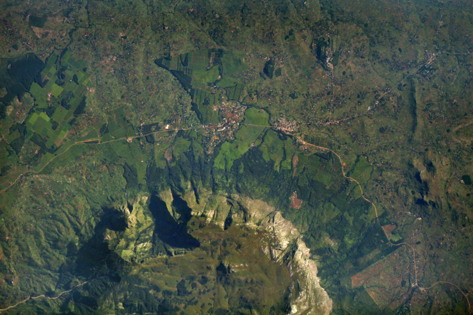
The Mulanje Massif, captured by the ISERV system aboard the International Space Station
Source: https://www.nasa.gov/image-article/servirs-iserv-image-of-mulanje-massif-malawi/

Satellite imagery and Earth-observation data go beyond playing a role in monitoring the impact of development efforts and can be used to plan responses to crises. In a post-pandemic world, good data on epidemiology and other public health issues have never been more valuable. Satellites are instrumental in collecting that data. Satellite data is increasingly leveraged for public health applications, including understanding the underlying factors that affect who is most at risk of illness. Recent advances in satellite data collection have helped researchers build a deeper and more nuanced understanding of public health issues. This in turn aids tailored responses, and in some cases can support preventative efforts. For instance, analysis of data collected by satellites can help identify where the next public health hazard might occur, enabling preventative action. This type of satellite service can be made even more powerful when used in concert with other emerging technologies like Artificial Intelligence and Machine Learning and Big Data projects.

A composite image of the Earth at night produced by imagery from the Moderate Resolution Imaging Spectroradiometer. This type of imagery has been used by public health researchers to better estimate at-risk populations

Current satellite technology and services are vulnerable to authoritarian or antidemocratic efforts. As satellites are, at their core, hardware, physical attacks remain a serious threat. Ground stations and terminals are often targeted in attempts to keep citizens from accessing satellite-enabled connectivity. Television antennas and satellite internet terminals are difficult to hide without reducing their efficacy, making them easy targets for police or antidemocratic security services who wish to limit citizens’ access. Designs for future systems have not been able to address the vulnerabilities current terminals have. In some extreme cases, satellite signals might be jammed to prevent citizens from accessing a service. Domestic regulations pose another hurdle. States maintain jurisdiction over the radiofrequency spectrum within their borders, and can use licensing and regulatory processes to control what type of connectivity systems are available to its citizens and foreign visitors.

Back to top

Opportunities

Satellites can have positive impacts when used to further democracy, human rights and governance. Read below to learn how to more effectively and safely think about satellite use in your work.

Skip a Step

Many citizens in digital deserts are now able to bypass traditional connectivity methods and leapfrog to benefitting from satellite-enabled connectivity. Improved internet connectivity provides a new avenue for citizens to benefit from civil services and engage in political discourse. Internet access can be expanded without needing expensive and intensive local infrastructure projects.

Digital Inclusion

Satellite data and services have agricultural uses beyond crop monitoring and resource optimization. Smallshare farmers, especially in LMICs without established banking infrastructure, are often excluded from traditional financial markets that only provide credit and not savings, loans, or other services. Women are also disproportionately affected by financial exclusion. Innovative lenders like the Harvesting Farmers Network use satellite technologies and remote sensing to address these gaps and help underserved agricultural producers. Earth-observation data can be used to assess agricultural productivity, helping lenders move beyond requiring a paper trail or other documentation and reducing barriers to financial market access.

Access to banking through satellite-enabled connectivity addresses populations beyond smallshare agricultural producers. Satellite connectivity helps geographically isolated populations utilize financial services. Satellites are helping un- or underserved populations across sub-Saharan Africa access banking, while Mexico has partnered with commercial satellite internet providers to achieve similar digital financial inclusion goals.

More Data, Less Hardware

Satellites may be expensive systems, but access to satellite services and data need not be a prohibitively large financial outlay. Satellite operators sometimes make data collected by their systems free to the public. This practice is common across government and industry. For example, the United States’ National Aeronautics and Space Administration provides a variety of free datasets to support an open and collaborative scientific culture around the world. Satellite industry actors take a slightly different approach to open data. Some commercial entities like Maxar have a long history of providing free and open data in times of crisis or after disasters to assist humanitarian responses.


Open sharing of satellite data across borders helps researchers tackle public health issues. Yet, there are still opportunities to better use satellite data. There is room to improve both the collection of remote sensing data and how we use that satellite-derived data. It is important for end-users to understand the effects of data preprocessing, as preprocessing can both help and hinder analyses. Different techniques can affect the utility of satellite data, sometimes streamlining the analytical process and eliminating the need for in-house expertise. On the other hand, receiving preprocessed data could limit the sophistication of the final analysis. When available, raw data might be the best option if an organization has the technical capacity and time to process the data. Thus, it is important to use imagery and remote sensing data that fit both an organization’s purpose and technical expertise.

A color-enhanced image of phytoplankton in the Patagonian Shelf Break, taken by the Suomi National Polar Orbiting Partnership Satellite Source: https://www.nasa.gov/image-article/colorful-plankton-full-patagonian-waters/

South-South Cooperation and Rejecting Post-Colonial Expectations

More and more countries are participating in developing satellite technology or utilizing the data from satellites, including those in the Global South. Many of these governments are collaborating or partnering with established industrial actors or other more advanced spacefaring nations. As more LMICs develop their local capacities, they also expand the potential for deeper South-South cooperation. Furthermore, the Global South can push back against colonial narratives by investing in satellite and space systems. States with colonial histories can push past expectations that they should base their economies on natural-resource extraction or other rudimentary products by delivering highly technical assets like satellites on a global scale.

Amazonia-1, Brazil’s first satellite, launching from Sriharikota in India Source: http://www.inpe.br/amazonia1/img/galeria/66.jpg

Back to top

Risks

The use of emerging technologies can also create risks in civil society programming. Read below about how to discern possible dangers associated with satellites in DRG work, as well as how to mitigate unintended – and intended – consequences.

Onerous Regulation

Arranging satellite connectivity is not as simple as turning a device on – broadcasters must receive specific authorizations and licenses from a country’s government to beam connectivity into their territory. Well-meaning but onerous government bureaucratic processes may delay when a population could start to benefit from satellite connectivity. In other cases, political interests might prevent satellite operators from serving a population in an attempt to control citizens’ access to information or opposition campaigns.

Signal Vulnerability

Satellite signals are vulnerable to interference, even if a satellite operator has full license to operate in a country. Signals are susceptible to both political and physical interference. Governments could choose to revoke licenses, effectively ending a satellite operator’s ability to legally provide connectivity services within a country’s borders with little to no warning. The bureaucratic hoops a service provider must jump through to receive a license are often more onerous than the process for a government to revoke a satellite connectivity provider’s right to broadcast a signal. There are few best practices or exemplary guidelines on what constitutes a reason to revoke a license, so each state is a unique case. It is not clear that many states have made thoughtful progress on understanding why and under what circumstances a satellite provider would lose a license to operate.

Overreliance

Just as a government could revoke a license, so too could a commercial company stop providing satellite services. Civil society must therefore be wary of becoming overly reliant on a single provider, lest this provider decide to cut service. A provider may cease serving a country for many reasons, including financial difficulties or political motivations. For example, Starlink connectivity was impeded, if not turned off entirely, in Ukraine during the war with Russia.

Actors in civil society who wish to work with other entities for satellite projects should also be careful to not become overly dependent on partners that hold overwhelming leverage over a project. The incentives that motivate technology transfer and the sharing of expertise are not always aligned among partners. Alignment issues can cause friction and affect the benefits of a project. This risk is also likely to be relevant in state-to-state interactions.

Unethical Data Access

In the wrong hands, satellite data could be used for a variety of malevolent purposes. Location data, maps, or logs of when a device was transmitting a signal to a satellite could be used by bad actors to erode one’s physical privacy. Satellite connectivity providers may sell users’ data, but some types of sensitive data could be obtained by third parties with sophisticated collection techniques. Few countries have established robust domestic regulations to limit the negative effects of electronic surveillance of satellite-enabled connectivity.

Financial Burden

Even with the attendant risks of overreliance, partnerships with commercial entities or foreign states may be necessary due to the high cost of developing and launching satellites. While advancements in manufacturing and launch have reduced the costs of deploying and operating a satellite, fit-for-purpose systems are still often prohibitively expensive. This is especially salient in light of states that have limited fiscal space and an obligation to address other social issues.

Talent Retention

States that do make a concerted effort to develop a satellite industry or provide state-supported satellite services for their citizens might also face challenges in retaining technical capacity. It is difficult for low- and middle-income countries to keep well-trained engineers and other professionals engaged in domestic satellite issues. These issues are even more acute when citizens are reliant on foreign partners and do not see pathways to growth and productivity at home. This problem is also exacerbated by the fact that government salaries cannot hope to match salaries in the private sector for tech experts. Without a domestic talent pool to draw from, states risk not being able to advocate for themselves in both negotiations for technical services and multilateral forums on space governance and norm setting.

Lack of Multilateral Governance

New paradigms like megaconstellations threaten future generations’ ability to benefit from technologies in Earth’s orbits. This risk of orbital overcrowding is similar to terrestrial-environmental-sustainability principles. Earth’s orbits may be massive in terms of total volume, but orbits are finite resources. There is a fine line between maximizing the uses of Earth’s orbits and launching so many objects into space that no satellite can operate safely. This overcrowding issue affects all of humanity, but is particularly acute for emerging or aspirational spacefaring states that may be forced to operate in a high-risk environment, having missed out on a window of opportunity to take their first steps in space during a relatively safer period of time. Such a situation has secondary effects – those states that are unable to safely commence their space activities are also less likely to be able to demonstrate and reinforce normative expectations for responsible behaviors. Pathways for participating in the current multilateral space governance processes are made more challenging by not having a demonstrated space capability.

There are few global rules that support sustainable and equitable uses of space. Some states have recently adopted more stringent regulations on how companies can use space, but the uncoordinated effort of a few states is unlikely to ensure humanity’s access to a low-risk orbital environment for generations to come. Achieving these space sustainability goals is a global endeavor that requires multilateral cooperation.

Back to top

Questions

To understand the implications of satellite used in your work, ask yourself these questions:

  1. Are there barriers that prevent the benefits of satellites from being leveraged in your country? What are they? Funding? Expertise? Lack of local governance?
  2. Are satellite-derived data or services tailored to your specific needs?
  3. How competitive is the market for satellite services in your area, and how does this competition, or lack thereof, affect the cost of accessing satellite services?
  4. Are the connectivity-enabling satellites you plan to use up to date on cyber security measures?
  5. What types of ground station(s) does the space system use, and is that infrastructure sufficiently secured from seizure or tampering?
  6. Does the satellite owner or operator adhere to or promote sustainable uses of space?
  7. What structural or regulatory changes must be enacted within your country of interest to extract the greatest value from a satellite system?
  8. How have satellite systems been implemented in other states and, if so, are there ways to avoid or overcome challenges prior to implementation?
  9. How can your use of satellite services or data promote the adoption of nascent international behaviors that would conserve your ability to access space services over the long term?
  10. Are you creating risky dependencies? How trustworthy and stable are the organizations you are relying on? Do you have a backup plan?
  11. Are the applications you are accessing through satellite connectivity secure and safe?

Back to top

Case Studies

Vanuatu voting registration

The United Nations Development Programme (UNDP) and the United Nations Satellite Centre (UNOSAT) partnered on an initiative to assist Vanuatu to register voters in preparation for Vanuatu’s 2021 provincial elections. UNOSAT used satellite data to develop the first complete dataset to represent all villages in the archipelago. This data was used in concert with measurements of voter turnout to quantify the impact of polling-station locations. Satellite data were used to locate difficult-to-reach populations and maximize voter turnout. Using satellite data helped streamline election-related work and reduced the burden on election officials.

Partnerships to Provide Imagery in Support of Peace

Satellites’ abilities to capture overhead imagery is especially valuable in documenting human-rights violations in states that restrict activists’ and inspectors’ access. A recent partnership between Human Rights Watch and Planet, a US-based company that operates Earth-observation satellites, enables activist groups to hold national leadership accountable. In this case, Human Rights Watch analyzed satellite images of Myanmar provided by Planet to confirm the burning of ethnically Rohingya villages. The frequent collection of satellite imagery showed that several dozen villages were burned, contradicting Myanmar leadership’s declarations that the state-sponsored clearance operations had ended. Activists used this uncovered truth to call for an urgent cessation of violence and support the delivery of humanitarian aid.

Satellite Television

Satellites enable many forms of mass communication, including television. While television is a diversion or luxury in many places around the world, it is also a powerful tool for shaping political discourse. Satellite television can provide citizenry with programming from around the globe, expanding horizons beyond local programming. Satellite television came to India in 1991 after years of state control over broadcast media. On the one hand, the format of receiving satellite internet was a marker of modernism, while on the other hand, the programming it provided became a societal phenomenon. Satellite television brought more than 300 new channels to India, nurturing cultural engagement and supporting how citizens considered engaging with each other and with the state. This was especially liberating in the post-colonial context, as Indian society now controlled their media outlets and showcased considerations of social identity through satellite television. For more information, please see Television in India: Satellites, politics, and cultural change.

Servir Ecologic Work

Through the Servir program, a collaborative initiative led by the United States Agency for International Development and the U.S. National Aeronautics and Space Administration, U.S. government agencies partner with local organizations in affected regions to use satellite data to design solutions to tackle environmental challenges around the world. Among many other contributions, the Servir team is working in concert with partners in Peru and Brazil to use satellite and geospatial data in precise maps to help inform decisions about agricultural and environmental policies. This work supports stakeholder efforts to understand the complex interface between agriculture productivity and environmental sustainability. The results are used to design policy incentives that promote sustainable farming of cocoa and palm oil. Local stakeholders including the farming communities can use the satellite-derived data to optimize their land use.

South-South Cooperation on Agricultural Monitoring

Satellites are invaluable tools in agricultural development. The CropWatch program, initiated by the Chinese Academy of Sciences, works to provide LMICs with access to data collected by satellites and training for using these data for their specific needs. The CropWatch program supports agricultural monitoring and enables states to better prepare for food security challenges. States have been able to engage with each other through extensive training programs, allowing for South-South collaboration on shared issues. The data collected through CropWatch can be tailored to accommodate local requirements.

Access to a Voice

Clandestine use of satellite internet has allowed protesters in Iran to access the internet via alternate methods. The Iranian government exercises close control over traditional methods of accessing the internet to stifle protests and civil activism. These methods of controlling or limiting free speech, democratic activism, and civil organization are yet to be effective in limiting citizens’ access to satellite internet, provided by services like Starlink. The Iranian government still exercises some control over satellite internet in the country – ground-station terminals need to be smuggled into the borders to provide service to activists.

Amnesty Decode Darfur Project

Satellites help confirm ground truths. Amnesty International has a long history of using satellite imagery to produce credible evidence of human-rights abuses. This project called for digital volunteers to map Darfur and identify potentially vulnerable populations. The next phase of the project compared satellite imagery of the same locations taken at different times to pinpoint evidence of attacks by the Sudanese government and associated security forces. Amnesty maintains its own in-house satellite-imagery-analysis team to corroborate on-the-ground accounts of violence, but this project showed that even amateur volunteer analysis of satellite imagery can be a viable way to investigate human-rights abuses and hold states accountable.

Back to top

References

Find below the works cited in this resource.

Additional Resources

Back to top

Categories

Smart Cities

What are smart cities?

Smart cities can take many forms, but generally leverage digital technologies like artificial intelligence (AI) and the Internet of Things (IOT) to improve urban living. The technologies and data collection that underpin smart cities have the potential to automate and improve service delivery, strengthen disaster preparedness, boost connectivity, and enhance citizen participation. But if smart cities are implemented without transparency and respect for the rule of law, they risk eroding good governance norms, undermining privacy, and extinguishing free expression.

How do smart cities work?

Solar power lights an evening market in Msimba, Tanzania. Smart cities monitor and integrate their infrastructure to optimize resource use. Photo credit: Jake Lyell.
Solar power lights an evening market in Msimba, Tanzania. Smart cities integrate technology with existing infrastructure to collect data and optimize resource use. Photo credit: Jake Lyell.

Smart cities integrate technology with new and existing infrastructure—such as roads, airports, municipal buildings, and sometimes even private residences—to optimize resource allocation, assess maintenance needs, and monitor citizen safety. The term “smart city” does not refer to a single technology, but rather to multiple technologies working together to improve the livability of an urban area. There is no official checklist for the technologies a city needs to implement to be considered “smart.” But a smart city does require urban planning, including a growth strategy managed by the local government with significant contributions from the private sector.

Data is at the heart of the smart city

Smart cities generally rely on real-time data processing and visualization tools to inform decision making. This usually means gathering and analyzing data from smart sensors installed across the city and connected through the Internet of Things to address issues like vehicular traffic, air pollution, waste management, and physical security.

Data collection in smart cities also provides a feedback mechanism to strengthen the relationship between citizens and local government when accompanied by transparency measures, such as making public information about official budgets and resource allocations. However, the misuse of sensitive personal data can alienate citizens and reduce trust. A detailed, rights-respecting data-management strategy can help ensure citizens understand (and consent to) how their data are collected, processed, and stored, and how they will be used to benefit the community.

All Smart Cities are different

Cities are extremely diverse, and the implementation of smart-city solutions will vary depending on location, priorities, resources, and capabilities. Some smart cities are built by overlaying ICTs on existing infrastructure, like in Nairobi, while others are built “from scratch,” like Kenya’s “Silicon Valley,” Konza City. Alongside technological development, other non-digital elements of smart cities include improvements to housing, increased walkability, the creation of new parks, the preservation of wildlife, etc. Ultimately an emphasis on improved governance and sustainability can generate better outcomes for citizens than an explicit focus on technology, digitization, and growth.

Smart cities in developing countries face unique legal, regulatory, and socioeconomic challenges.

Drivers for Smart City Development in Developing Countries

  • Financing capacity of the government
  • Regulatory environment that citizens and investors trust
  • Technology and infrastructure readiness
  • Human capital
  • Stability in economic development
  • Active citizen engagement and participation
  • Knowledge transfer and participation from the private sector
  • Ecosystem that promotes innovation and learning

Barriers to Smart City Development in Developing Countries

  • Budget constraints and financing issues
  • Lack of investment in basic infrastructure
  • Lack of technology-related infrastructure readiness
  • Fragmented authority
  • Lack of governance frameworks and regulatory safeguards
  • Lack of skilled human capital
  • Environmental concerns
  • Lack of citizen participation
  • Technology illiteracy and knowledge deficit

Children playing at Limonade plaza, Haiti. Improving the quality of life for citizens is at the heart of smart city projects. Photo credit: Kendra Helmer/USAID.
Children playing at Limonade plaza, Haiti. Smart city projects can improve the quality of life for citizens. Photo credit: Kendra Helmer/USAID.

The development of a smart city that truly benefits citizens requires careful planning that typically takes several years before city infrastructure can be updated. The implementation of a smart city should take place gradually as political will, civic demand, and private-sector interests converge. Smart city projects can only be successful when the city has developed basic infrastructure and put into place legal protections to ensure citizens’ privacy is respected and safeguarded.The infrastructure needed for smart cities is expensive and requires routine, ongoing maintenance and review by skilled professionals. Many planned smart-city projects have been reduced to graveyards of forgotten sensors due to the lack of proper maintenance, or because the data gathered were not ultimately valuable for the government and citizens.

Common Elements of a Smart City

Below is an overview of technologies and practices common to smart cities, though this list is by no means exhaustive or universal.

Open Wi-Fi: Affordable and reliable internet connectivity is essential for a smart city. Some smart cities provide free access to high-speed internet through city-wide, wireless infrastructure. Free Wi-Fi can facilitate data collection, support emergency response services, and encourage residents to use public places.

Internet of Things (IoT): The Internet of Things is an expanding network of physical devices connected through the internet. From vehicles to refrigerators to heating systems, these devices communicate with users, developers, applications, and one another by collecting, exchanging, and processing data. For example, data collected from smart water meters can inform better responses to problems like water leaks or water waste. The IoT is largely facilitated by the rise of smartphones, which allow people to easily connect to one another and to other devices.

5G: Smart city services need internet with high speeds and large bandwidth to handle the amount of data generated by the IoT and to process these data in real time. The increased connectivity and computing capacity of 5G internet infrastructure facilitates many of the internet-related processes needed for smart cities.

Smart Grids: Smart grids are energy networks that use sensors to collect real-time data about energy usage and the requirements of infrastructure and citizens. Beyond controlling utilities, smart grids monitor power, distribute broadband to improve connectivity, and control processes like traffic. Smart grids rely on a collection of power-system operators and involve a wide network of parties, including vendors, suppliers, contractors, distributed generation operators, and consumers.

Intelligent Transport Systems (ITS): Through intelligent transport systems, various transportation mechanisms can be coordinated to reduce energy usage, decrease traffic congestion, and decrease travel times.. ITSs focus on “last mile delivery”, or optimizing the final step of the delivery process. Autonomous vehicles often are associated with smart cities, but ITS goes far beyond individual vehicles.

Surveillance: As with connected objects, data about residents can be transmitted, aggregated, and analyzed. In some cases, existing CCTV cameras can be paired with advanced video-analytics software and linked to the IoT to manage traffic and public safety. Solutions for fixed video-surveillance infrastructure account for the vast majority of smart city surveillance globally, but mobile-surveillance solutions are also growing fast. The expansion of surveillance to personal identification is a hotly debated topic with significant ramifications for civil society and DRG actors.

Digital IDs and Services Delivery: Digital-identification services can link citizens to their city by facilitating the opening of a bank account or access to health services. Digital IDs centralize all information and transaction history, which is convenient for citizens but also introduces some security concerns. Techniques like minimal disclosure (relying on as little data as possible) and decentralized technologies like self sovereign identity (SSI) can help separate identity, transaction, and device.

E-government: Electronic government—the use of technology to provide government services to the public—aims to improve service delivery, enhance citizen engagement, and build trust. Making more information, such as government budgets, public and available to citizens is a primary element of e-government. Mobile smartphone service is another strategy, as mobile technology combined with an e-government platform can offer citizens remote access to municipal services.

Chief Technology Officer: Some smart cities have a Chief Technology Officer (CTO) or Chief Information Officer (CIO), who leads the city’s efforts to develop creative and effective technology solutions in collaboration with residents and elected officials. The CTO or CIO studies the community, learns the needs of the citizens, plans and executes related initiatives, and oversees implementation and continued improvements.

Interoperability: The many different services and tools used in a smart city should be able to function together, to communicate with each other, and to share data. This requires dialogue and careful planning between business suppliers and city governments. Interoperability means that new infrastructure must be able to function on top of a city’s existing infrastructure (for example, installing new “smart” LED lighting on top of existing city streetlight systems).

“A smart city is a process of continuous improvements in city operation methods. Not a big bang.”

Smart city project leader in Bordeaux, France

Back to top

How are smart cities relevant in civic space and for democracy?

As described in more detail in the opportunities  section of this resource, smart cities can enhance energy efficiency, improve disaster preparedness, and increase civic participation. But smart cities are, in many ways, a double-edged sword, and they can also facilitate excessive surveillance and infringe on the rights to free assembly and expression.

Streetlights in Makassar, Indonesia. Smart cities have the potential to reach carbon reduction and renewable energy goals and improve economic efficiency and power distribution. Photo credit: USAID.

In authoritarian countries, smart cities can become powerful instruments for manipulation and control. Smart cities in China, for example, are linked to the Chinese Communist Party’s concept of “social management,” or the ruling party’s attempts to shape, manage, and control society. When implemented without transparency or respect for the rule of law, smart-city technologies—like a smart electricity meter intended to improve the accuracy of readings—can be abused by the government as an indicator of “abnormal” behaviors indicative of “illegal” gatherings. In extreme instances, smart-city-facilitated surveillance and monitoring could dissuade citizens from gathering to protest or otherwise expressing opposition to local laws and guidelines.

The involvement of authoritarian actors in the design and operation of smart cities presents a significant threat to democracy, particularly in countries with pre-existing illiberal trends or weak oversight institutions. The partners of the Chinese tech company Huawei—which provides smart-city “solutions” that include facial and license-plate recognition, social media monitoring, and other surveillance capabilities—tend to be non-liberal, raising concerns that the Chinese Communist Party is exporting authoritarianism. In at least two cases, Huawei technicians “helped African governments spy on their political opponents, including [by] intercepting their encrypted communications and social media, and using cell data to track their whereabouts.”

Developing a rights-respecting smart city requires the active participation of society, from the initial planning stages to the implementation of the project. Mechanisms that enable citizens to voice their concerns and provide feedback could go a long way toward building trust and encouraging civic participation down the line. Education and training programs should also be implemented during smart city planning to help citizens understand how to use the technology around them, as well as how it will benefit their day-to-day lives.

Smart cities can create new avenues for participation in democratic processes, such as through e-voting. Proponents of e-voting stress benefits like “faster results, cost-reduction, and remote accessibility, which can potentially increase voter turnout.” But they tend to “underestimate the risks such as election fraud, security breaches, verification challenges, and software bugs and failures.” While smart cities center around technology-focused policymaking, the challenges experienced by urban communities require structural solutions of which technology is just one component.

Nairobi Business Commercial District, Kenya. Some smart cities, like Nairobi, are built on the existing infrastructure of cities. Photo credit: USAID East Africa Trade and Investment Hub.

Smart-city technology may also result in a more privatized government infrastructure, ultimately “displac[ing] public services, replac[ing] democracy with corporate decision-making, and allow[ing] government agencies to shirk constitutional protections and accountability laws in favor of collecting more data.” In some instances, authorities working to secure contracts for smart city technologies have declined to disclose information about the negotiations or circumvented standard public procurement procedures altogether.

Thus, privacy standards, data protection regulations, and due process systems are all vital components of a smart city that truly benefits citizens. Robust legal infrastructure can also provide citizens with recourse in the event of discrimination or abuse, even prior to the development of a smart city. In India, “the drive for smart cities triggered evictions of people from slums and informal settlements without adequate compensation of alternate accommodation.” Too often smart cities that brand themselves as “inclusive” primarily benefit the elite and fail to address the needs of women, children, migrants, minorities, persons with disabilities, persons operating in the informal economy, low-income groups, or persons with lower levels of digital literacy. Given the varying legal standards across countries, human rights frameworks can help inform the equitable implementation of smart cities to ensure they benefit the whole of society, including vulnerable communities. Civil society and governments should consider 1) whether the technology is appropriate for the objective and achieves its goal, 2) whether the technology is necessary in that it does not exceed its purpose and there is no other way to achieve the goal, and 3) whether the technology is proportionate, meaning that related challenges or drawbacks will not outweigh the benefit of the result.

Back to top

Opportunities

Smart cities can have a number of positive impacts when used to further democracy, human rights, and good governance.

Environmental Sustainability

According to the OECD, modern cities use almost two-thirds of the world’s energy, produce up to 80% of global greenhouse-gas emissions, and generate 50% of global waste. Smart cities can contribute toward Sustainable Development Goal 11 on making cities and human settlements inclusive, safe, resilient, and sustainable by leveraging data to improve economic efficiency and power distribution, ultimately reducing a city’s carbon footprint and introducing new opportunities for renewable energy. Smart cities are often linked to circular economic practices, which include “up-cycling” of rainwater, waste products, and even open public data (see below).. In addition, smart city technologies can be leveraged to help prevent the loss of biodiversity and natural habitats.

Disaster Preparedness

Smart cities can help improve disaster preparedness, mitigation, response, and recovery. Data collection and analysis can be applied to monitoring environmental threats, and remote sensors can map hazards. For example, open data and artificial intelligence can be used to identify which areas are most likely to be hardest hit by earthquakes. Early warning systems, social media alert systems, GIS, and mobile systems can also contribute to disaster management. A major issue during natural disasters is the loss of communication; in a smart city, interconnected systems can share information about what areas need assistance or replenishment when individual communication channels go down.

Social Inclusion

Smart cities can facilitate social inclusion in important ways: through fast, secure internet access; improvements in access to government and social services; avenues for citizen input and participation; improvements in transportation and urban mobility; etc. For example, smart cities can establish a network of urban access points where residents can access digital-skills training while the digitization of health services can improve healthcare opportunities and help patients connect to their medical records. Cities may even be able to improve services for vulnerable groups by responsibly leveraging sensitive datasets to improve their understanding of these citizens’ needs—though this data must be given with full consent, and robust privacy and security safeguards must be in place. Smart city technologies can also be used to preserve cultural heritage.

Knowledge Sharing and Open Information

An open approach to data captured by smart technologies can bring government, businesses, and civil society closer together. Public or open data—unlike sensitive, private data—are data that anyone can access, use, and share. An open-access approach to data means allowing the public to access these kinds of public, reusable data to leverage the social and economic benefits for themselves. This approach can also provide transparency and reinforce accountability and trust between citizens and government—for example by showing the use of public funds. In addition to open data, the design of software underlying smart city infrastructure can be shared with the public through open-source design and open standards. Open source refers to technology whose source code is freely available publicly, so that anyone can review it, replicate it, modify it, or extend it. Open standards are guidelines that help ensure that technology is designed to be open source in the first place.

Citizen Participation

Smart cities can encourage citizens to participate more actively in their communities and their governance by facilitating volunteering and community engagement opportunities and by soliciting feedback on the quality of services and infrastructure. Sometimes referred to as “e-participation,” digital tools can reduce the barriers between citizens and decision making, facilitating their involvement in the development of laws and standards, in the choice of urban initiatives, etc. The United Nations identifies three steps in e-participation: E-information, E-consultation, and E-decision-making.

Back to top

Risks

The use of emerging technologies can also create risks in civil society programming. This section describes how to discern the possible dangers associated with Smart Cities in DRG work, as well as how to mitigate unintended—and intended—consequences.

Surveillance and Forced-Participation

As noted above, smart cities often rely on some level of citizen surveillance, the drawbacks of which are typically de-emphasized in marketing campaigns. A planned smart-city project in Toronto, Canada touted as a tool for addressing affordability and transportation issues in the city was ultimately derailed by the COVID-19 pandemic and significant scrutiny over privacy and data harvesting.

In many countries, individuals must give informed consent for their data to be legally collected, stored, and analyzed. Even if users blindly opt-in to providing their data to a website or app, at least there is a clear option for opting out of doing so. In public spaces, however, there is no straightforward way for people to opt out of giving their consent.. Do citizens consent to being surveilled when they are crossing the street? Have they been informed about how data collected on their movements and behaviors will be used? In democracies, there are opportunities for recourse if personal data collected through surveillance are misused, but in more illiberal settings this may not be the case. In China, for example, the use of millions of surveillance cameras that recognize faces, body shapes, and how people walk facilitates the tracking of individuals to stifle dissent.

Discrimination is sometimes made easier because of smart city surveillance and facial recognition technology. Smart city infrastructure can provide law enforcement and security agencies with the ability to track and target certain groups such as ethnic or racial minorities. This happens in democratic societies as well as non-democratic ones. A 2019 study conducted by the U.S. National Institute of Standards and Technology found that facial-recognition algorithms perform poorly when examining the faces of women, people of color, the elderly, and children. This is particularly concerning given that many police departments use facial recognition technology to identify suspects and make arrests. In addition to facial recognition,  data analytics are used to anticipate potential locations of future crime (a practice known as predictive policing ). A typical response to this analysis is an increase in the surveillance of “high-risk” areas, often neighborhoods inhabited by lower income and minority communities.

Unethical Data Handling and Freedom of Expression

As a city becomes more digitally connected, data sharing increases. For example, a smartphone user may share geo-location data and other meta-data with multiple applications, which in turn share that data with other services. And yet as cities aggregate and process data about residents, expectations of privacy in people’s daily lives break down. The collection of some types of data, like information about where you have traveled in your car or how fast you typically drive, may seem harmless. But when paired with other data, patterns are quickly established that may reveal more sensitive information about your health and habits, your family and networks, the composition of your household, your religious practices, etc.

Personal information is valuable to companies, and many companies test their technology in countries with the fewest data restrictions. In the hands of private companies, data can be exploited to target advertising, calibrate insurance costs, etc. There are also risks when data are collected by third parties (particularly foreign companies) that might lock users into their services, neglect to share information about security flaws, have inadequate data-protection mechanisms, or maintain data-sharing agreements with other governments. Governments also stand to benefit from access to intimate data about their citizens: “[P]ersonal information collected as part of a health survey could be repurposed for a client that is, say, a political party desperate to win an election.” According to Ghanaian social innovator and entrepreneur Bright Simmons, “the battle for data protection and digital rights is the new fight for civil rights on the continent.”

Worsening Inequality and Marginalization

In many cases, smartphones and the apps contained within them facilitate access to the full benefits of a smart city. . As of 2019, an estimated five billion people owned a mobile device, and over half of those devices were smartphones. But these numbers vary between advanced and developing economies, as well as between communities or groups within a given economy, potentially generating inequity in access to services and civic participation. Citizens with low literacy and numeracy skills, or who do not speak the language used by an application, will have further difficulty connecting through these interfaces. The reliance on apps also alienates unhoused populations who may not be able to charge their devices regularly or  be at higher risk of their devices being stolen.

The term “digital divide” generally refers to the gap between people who have access to and familiarity with high-quality and secure technology, and those who do not.  Smart cities are often criticized as being designed for the elite and privileging those who are already digitally connected. If this is the case, smart cities could exacerbate gentrification and the displacement of the unhoused.

The use of surveillance in smart cities can also be used to repress minority groups. Much has been reported on government surveillance of China’s Uyghur Muslim population in Xinjiang..

“It aggregates data – from people’s blood type and height, to information about their electricity usage and package deliveries – and alerts authorities when it deems someone or something suspicious. It is part of the Integrated Joint Operations Platform (IJOP), the main system for mass surveillance in Xinjiang.”As described by Human Rights Watch

Data Despotism and Automation Failures

Smart cities have been accused of “data despotism.” If city governments can access so much data about their citizens, then why bother speaking with them directly? Because of potential algorithmic discrimination, flaws in data analysis and interpretation, or inefficiencies between technology and humans, an overreliance on digital technology can harm society’s most vulnerable.

Much literature, too, is available on the “digital welfare state.” Former United Nations Special Rapporteur on extreme poverty and human rights Philip Alston observed that new digital technologies are changing the relationship between governments and those most in need of social protection: “Crucial decisions to go digital have been taken by government ministers without consultation, or even by departmental officials without any significant policy discussions taking place.”

When basic human services are automated  and human operators are taken out of the transaction, glitches in the software and tiny flaws in eligibility systems can be dangerous and even fatal. In India, where many welfare and social services have been automated, a 50-year-old man died of malnutrition due to a glitch in his biometric thumbprint identifier that prevented him from accessing a ration shop. “Decisions about you are made by a centralised server, and you don’t even know what has gone wrong…People don’t know why [welfare support] has stopped and they don’t know who to go to to fix the problem,” explained Reetika Khera, an associate professor of economics at the Indian Institute of Management Ahmedabad.

These automated processes also create new opportunities for corruption. Benefits like pensions and wages linked to India’s digital ID system  (called Aadhaar) are often delayed or fail to arrive altogether. When a 70-year-old woman found that her pension was being sent to another person’s bank account, the government told her to resolve the situation by speaking directly to that person.

Worsening Displacement

Like other urban projects, smart-city development can displace residents as existing neighborhoods are razed for new construction. An estimated 60% to 80% of the world’s forcibly displaced population lives in urban areas (not in camps as many would think), and one billion people (a number expected to double by 2030) in developing cities live in “slum” areas—defined by the UN as areas without access to improved water, sanitation, security, durable housing, and sufficient living area. In other words, urban areas are home to large populations of society’s most vulnerable, including internally displaced persons and migrants who do not benefit from the same legal protections as citizens. Smart cities may seem like an ideal solution to urban challenges, but they risk further disadvantaging these vulnerable groups; not to mention that smart cities neglect the needs of rural populations entirely.

“Corporatization”: Dominance of the Private Sector

Smart cities present an enormous market opportunity for the private sector, sparking fears of the “corporatization of city governance.” Large IT, telecommunication, and energy-management companies such as Huawei, Alibaba, Tencent, Baidu, Cisco, Google, Schneider Electric, IBM, and Microsoft are the driving forces behind the technology for smart-city initiatives. As Sara Degli-Esposti, an honorary research fellow at Coventry University, explained: “We can’t understand smart cities without talking of digital giants’ business models…These corporations are already global entities that largely escape governmental oversight. What level of control do local governments expect to exercise over these players?”

The important role thereby afforded to international private companies in municipal governance raises sovereignty concerns for governments, along with the privacy concerns for citizens cited above. In addition, reliance on private- sector software and systems can create a condition of business lock-in (when it becomes too expensive to switch to another business supplier). Business lock-in can get worse over time: as more services are added to a network, the cost of moving to a new system becomes even more prohibitive.

Security Risks

Connecting devices through a smart grid or through the Internet of Things brings serious security vulnerabilities for individuals and infrastructure. Connected networks have more points of vulnerability and are susceptible to hacking and cyberattacks. As smart systems collect more personal data about users (like health records), there is an increased risk that unauthorized actors will gain access to this information. The convenience of public, open Wi-Fi also comes at a cost, as it is much less secure than private networks. The IoT has been widely criticized for its lack of security, in part because of its novelty and lack of regulation. Connected devices are generally manufactured to be inexpensive and accessible, without cybersecurity as the primary concern.

The more closely linked infrastructure is, the faster and more far-reaching an attack can be. Digitally linked infrastructure like smart grids increases cybersecurity risks due to the increased number of operators and third parties connected to the grid, and this multiplies supply-chain risk-management considerations. According to Anjos Nijk, director of the European Network for Cyber Security: “With the current speed of digitisation of the grid systems.. and the speed of connecting new systems and technologies to the grids, such as smart metering, electrical vehicle charging and IoT, grid systems become vulnerable and the ‘attack surface’ expands rapidly.” Damaging one part of a large, interconnected system can lead to a cascade effect on other systems, potentially resulting in large-scale blackouts or the disabling of critical health and transportation infrastructure. Energy grids can be brought down by hackers, as experienced in the December 2015 Ukraine power grid cyberattack.

Back to top

Questions

If you are trying to understand the implications of smart cities in your work environment, or are considering how to use aspects of smart cities as part of your DRG programming, ask yourself these questions:

  1. Does the service in question need to be digital or connected to the internet? Will digitization improve this service for citizens, and does the anticipated improvement outweigh the risks?
  2. Are programs in place to ensure that citizens’ basic needs are being met (access to food, safety, housing, livelihood, education)?
  3. What external actors have control of or access to critical aspects of the technology and infrastructure this project will rely on, and what cybersecurity measures are in place?
  4. Who will build and maintain the infrastructure and data? Is there a risk of being locked into certain technologies or agreements with service providers?
  5. Who has access to collected data and how are the data being interpreted, used, and stored? What external actors have access? Are data available for safe, legal re-use by the public? How are open data being re-used or shared publicly?
  6. How will smart city services respect citizens’ privacy? How will residents’ consent be obtained when they utilize services that capture data about them?Can they opt out of sharing this information? What legal protections are in place around data protection and privacy?
  7. Are the smart services transparent and accountable? Do researchers and civil society have access to the “behind the scenes” functioning of these services (data, code, APIs, algorithms, etc.)?
  8. What measures are in place to address biases in these services? How will this service be certain not to exacerbate socioeconomic barriers and existing inequalities? What programs and measures are in place to improve inclusion?
  9. How will these developments respect and preserve historical sites and neighborhoods?  How will changes adapt to local cultural identities?

Back to top

Case Studies

Barcelona, Spain

Barcelona is often referred to as a best-practice smart city due to its strongly democratic, citizen-driven design. Its smart-city infrastructure consists of three primary components: Sentilo, an open-source data-collection platform; CityOS, a system for processing and analyzing the collected data; and user interfaces that enable citizens to access the data. This open-source design mitigates the risk of business lock-in and allows citizens to maintain collective ownership of their data, as well as provide input on how it is processed. A digital participatory platform, Decidim (“We Decide”), enables citizen participation in government through the suggestion and debate of ideas. Barcelona has also implanted e-democracy initiatives and projects to improve the digital literacy of its citizens. In 2018, Barcelona’s Chief Technology and Digital Innovation Officer Francesca Bria commented on reversing the smarty city paradigm: “Instead of starting from technology and extracting all the data we can before thinking about how to use it, we started aligning the tech agenda with the agenda of the city.”

Belgrade, Serbia

Starting in 2019, the Serbian government began implementing a Safe City project in the capital city of Belgrade. The installation of 1,200 smart surveillance cameras provided by Chinese tech giant Huawei raised red flags among the public, civil society, and even some European Union institutions. The Serbian Commissioner for Information of Public Importance and Personal Data Protection was among the first to sound the alarm, stating “there is no legal basis for the implementation of the Safe City project” and that new regulation was needed to address facial-recognition technology and the processing of biometric data. As Danilo Krivokapić, director of the Belgrade-based digital rights organization SHARE Foundation observed, “The public was not informed about the technical scope or price of the system, the specific needs it was meant to address, or the safeguards that would be needed to mitigate potential human rights risks.” In an effort to improve transparency around the project, the SHARE Foundation developed a crowdsourced map showing verified camera locations and their technical features, which ended up differing substantially from a list of camera locations provided by officials. Two years after the rollout of the Safe City project in Belgrade, a group of MEPs wrote a letter to the European Parliament’s Minister of Interior to voice their concerns about Belgrade becoming “the first city in Europe to have the vast majority of its territory covered by mass surveillance technologies.”

Konza, Kenya

Konza Technopolis, a flagship of Kenya’s Vision 2030 economic-development plan, promises to be a “world-class city, powered by a thriving information, communications, and technology (ICT) sector; superior reliable infrastructure; and business-friendly governance systems.” Plans for the city include the gathering of data from smart devices and sensors embedded in the urban environment to inform the delivery of digitally enhanced services. According to the official website for Konza, the city’s population will have direct access to collected data (such as traffic maps, emergency warnings, and information about energy and water consumption), which will enable citizens to “participate directly in the operations of the city, practice more sustainable living patterns, and enhance overall inclusiveness.” Between the announcement of plans for the development of Konza in 2008 and a journalist’s trip to the city in 2021, little progress seemed to have been made despite claims that the city would create 100,000 jobs by 2020 and generate $1 billion a year for the Kenyan economy. Yet investment from South Korea may have given new life to the project in 2023, as new projects were set to take place, including the development of an Intelligent Transport System (ITS) and an integrated control center.

Neom, Saudi Arabia

In 2021, Saudi Crown Prince Mohamed bin Salman revealed initial plans for The Line, a futuristic linear city that would be constructed vertically, have no roads or cars, and run purely on renewable energy. The Line is part of the $500 billion Neom mega-city project, which has been described not just as a “smart” city, but as a “cognitive” one. This cognitive city is built on three pillars: “the ability for citizens and enterprises to connect digitally to physical things; the ability to be able to compute or to analyze those things; and the ability to contextualize, using that connectivity to drive new decisions.” Planning documents produced by U.S. consultants include some technologies that do not even exist yet, such as flying taxis, “cloud seeding” to produce rain, and robot maids. In addition to being somewhat fantastical, the project has also been controversial from the outset. Around 20,000 people, including members of the Huwaitat indigenous tribe, faced forced relocation due to construction for the project; according to Al Jazeera, a prominent Huwaitat activist was arrested and imprisoned in 2020 over the tribe’s refusal to relocate. Concerns also stemmed from the strengthening of ties between the crown prince and Chinese Communist Party chairman Xi Jinping, who agreed to provide powerful surveillance technology to Saudi Arabia. Marwa Fatafta, a policy manager at the Berlin-based digital rights organization Access Now, warned that smart city capabilities could be deployed as a tool for invasive surveillance by state security services. This could include deploying facial recognition technology to track real-time movements and linking this information with other datasets, such as biometric information. Saudi Arabia has a demonstrated track record of using technology to crack down on online expression, including through the use of Pegasus spyware to monitor critics and the stealing of personal data from Twitter users who criticized the government.

Singapore

Singapore’s Smart Nation initiative was launched in 2014 to harness ICT, networks, and data to develop solutions to an aging population, urban density, and energy sustainability. In 2023, Singapore was named the top Asian city in the Institute for Management Development’s Smart City index, which ranks 141 cities by how they use technology to achieve a higher quality of life. Singapore’s smart-city infrastructure includes self-driving cars; patrol robots programmed to detect “undesirable” behavior; home utilities management systems; robots working in construction, libraries, metro stations, coffee shops, and the medical industry; cashless payment systems; and augmented and virtual reality services. Hundreds of gadgets, sensors, and cameras spread across 160 kilometers of expressways and road tunnels (collectively called the Intelligent Transport Systems or ITS) gather data to monitor and manage traffic flows and make roads safer. Singapore’s e-health initiative includes an online portal that allows patients to book appointments and refill prescriptions, telemedicine services that allow patients to consult with doctors online, and wearable IoT devices that monitor patients’ progress during telerehab. In a country where an estimated 90% of the population own smartphones, Singapore’s Smart Nation app is a one-stop platform for accessing a wide range of government services and information.

Toronto, Canada

In 2017, Toronto awarded a contract to Sidewalk Labs, a smart-city subsidiary of Google’s parent company Alphabet, to develop the city’s eastern waterfront into a high-tech utopia. The project aimed to advance a new model of inclusive development, “striving for the highest levels of sustainability, economic opportunity, housing affordability, and new mobility,” and serve as a model for solving urban issues in cities around the world. Sidewalk Labs planned to build sustainable housing, construct new types of roads for driverless cars, and use sensors to collect data and inform energy usage, help curb pollution, and lessen traffic. However, the project faced constant criticism from city residents and even Ontario’s information and privacy commissioner over the company’s approach to privacy and intellectual property. A privacy expert left their consulting role on the initiative to “send a strong statement” about the data privacy issues the project faced after learning that third parties could access identifiable information gathered in the waterfront district. Ultimately the project was abandoned in 2022, allegedly due to the unprecedented economic uncertainty brought on by the COVID-19 pandemic.

Back to top

References

Find below the works cited in this resource.

Additional Resources

Back to top

Categories

Digital Development in the time of COVID-19